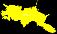
Kanagawa Prefecture
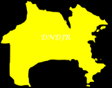
Honshu Island
Capital Yokohama City Area 2,415 Square Kilometers Population Density 3745.4 People Per Square Kilometer Relative Location South / Southeast of Tokyo Absolute Location 139°63' E. Longitude 35°44' N. Latitude |

|
|
|
|
Kanagawa Prefecture is located on the eastern coast of Honshu at the entrance to Tokyo Bay. If you use your imagination, you can think of Kanagawa Prefecture as being shaped like a camel. The head, neck, and legs would form part of the border of Tokyo Bay. Kawasaki and Yokosuka also have major Tokyo Bay ports. The southern side of the prefecture lies along Sagami Bay and the Pacific Ocean. The coast has beautiful sandy beaches which are popular with people across the Kanto Plain.
The western portion of the prefecture is dominated by mountains and lakes. The Hakone area is part of the Fuji-Hakone-Izu National Park. Closer to border with Yamanashi Prefecture is Tanzawa-Oyama Quasi-National Park. It is home to the three highest mountains in the prefecture. There are also several other smaller prefectural parks scattered around western Kanagawa Prefecture. Major Rivers in Kanagawa Prefecture include the Tama River, Nakatsu River, Sagami River, and the Sakai River.
The western portion of the prefecture is dominated by mountains and lakes. The Hakone area is part of the Fuji-Hakone-Izu National Park. Closer to border with Yamanashi Prefecture is Tanzawa-Oyama Quasi-National Park. It is home to the three highest mountains in the prefecture. There are also several other smaller prefectural parks scattered around western Kanagawa Prefecture. Major Rivers in Kanagawa Prefecture include the Tama River, Nakatsu River, Sagami River, and the Sakai River.
MIURA PENINSULA
Miura Peninsula is an important Kanagawa Prefecture that borders both Tokyo Bay and the Pacific Ocean. If you use your imagination and think of Kanagawa's profile as a camel, the front leg would be Miura Peninsula. This page includes just a few of the many places that you can experience on Miura Peninsula. Enjoy!
Misaki Port 三崎港 - Life at the Eastern Tip of Kanagawa Prefecture
Miura City and Jogashima are located on Miura Peninsula in eastern Kanagawa Prefecture. While not as famous as Yokohama or the beautiful beaches of Shonan, it is well worth the trip from Yokohama and Tokyo. Forget Tsukiji and come to Misaki! The people are friendlier and the crowds are smaller!
Miura City and Jogashima are located on Miura Peninsula in eastern Kanagawa Prefecture. While not as famous as Yokohama or the beautiful beaches of Shonan, it is well worth the trip from Yokohama and Tokyo. Forget Tsukiji and come to Misaki! The people are friendlier and the crowds are smaller!
|

|
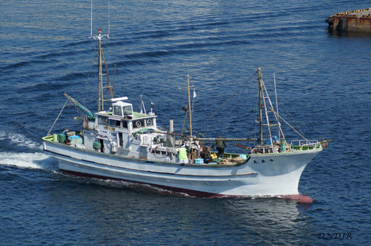
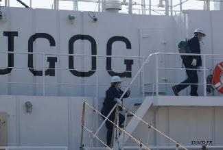
Misaki, now within Miura City, started out as a small fishing villages along Honshu's Pacific coast. But, eventually, its prime location near the by the coming together of water from the Oyashio and Kuroshio ocean currents. By the late 1920's larger port facilities werebuilt and larger deep-sea fishing vessels started to operate from Misaki. The fishing industry thrived up to and during World War II.
But when Japan lost the war in 1945, the allied powers occupied Japan and regulated most economic activities. On June 22, 1946 the Supreme Commander for the Allied Powers (SCAP) issued SCAPIN 1033. This specified the "Area Authorized for Japanese Fishing and Whaling." This document was very detailed with a myriad of boundaries listed including a prohibition of passing the 165° line of longitude. SCAPIN 1033 eventually became known as the "MacArthur Line" and it restricted Japanese fishing until the end of the occupation in April 1952. Unfortunately, American nuclear testing in the Pacific Ocean in the 1950s and 1960s also impacted the fisherman of Misaki. Wide areas of contamination and exclusion zones closed many of their former fishing grounds. This spurred Japanese commercial fisherman to expand their operations to oceans around the world.
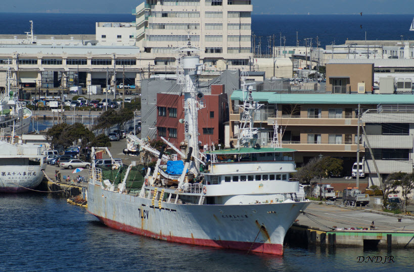
Misaki's economy continues to rely heavily on both local and deep-sea commercial vessels. Vessels from around Japan continue as well as the large Misaki Fish Market.
But when Japan lost the war in 1945, the allied powers occupied Japan and regulated most economic activities. On June 22, 1946 the Supreme Commander for the Allied Powers (SCAP) issued SCAPIN 1033. This specified the "Area Authorized for Japanese Fishing and Whaling." This document was very detailed with a myriad of boundaries listed including a prohibition of passing the 165° line of longitude. SCAPIN 1033 eventually became known as the "MacArthur Line" and it restricted Japanese fishing until the end of the occupation in April 1952. Unfortunately, American nuclear testing in the Pacific Ocean in the 1950s and 1960s also impacted the fisherman of Misaki. Wide areas of contamination and exclusion zones closed many of their former fishing grounds. This spurred Japanese commercial fisherman to expand their operations to oceans around the world.
Misaki's economy continues to rely heavily on both local and deep-sea commercial vessels. Vessels from around Japan continue as well as the large Misaki Fish Market.
|

Mt. Fuji is visible from many parts of Misaki and Jogashima. This picture was taken on the Misaki side of Jogashima toll bridge.
|
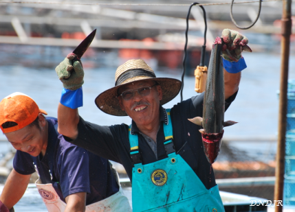
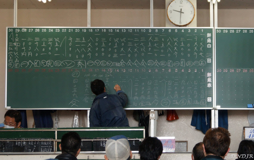
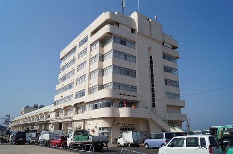
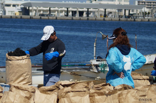
Most of the fish brought into Misaki is off-loaded and taken to the Misaki Fish Market. A huge freezer building is located behind the market and it can be used to store fish until the next auction. There is also a large ice-making facility next to the market that provides ice to store fresh fish. The Misaki Fish Market is located in a long building next to the pier and is essentially broken into two major sections. The section closest to the entrance is used to separate fish that is brought in from the fishing boats. They are sorted and then placed in different containers based on their species. Buyers can walk among the fish to place bids and material on the floor to help reduce bacteria.
The frozen tuna are weighed prior to the sale and each is marked with the weight. A small portion of the tuna is cut out and attached to each tuna. This allows the buyers to determine the quality of each tuna. Generally, tuna that contains more white than red meat will bring a higher price.
Visitors to the market are not allowed on the first floor where the fish sales occur. But, the market has an excellent second floor viewing area that allows you to look down at the activity on the first floor. Most visitors will want to get to the Misaki Fish Market around 7:00 AM (always check in advance if possible). The fish auction is normally closed down and cleaned-up by around 10:00.
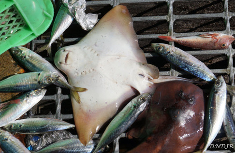
Bycatch litters the floor of the Misaki Fish Market. Sharks,
rays, and other creatures fall victim to modern commercial fishing.
|
The visitor entrance is located above the post office. Steps take visitors up to the second floor.

|
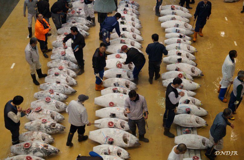
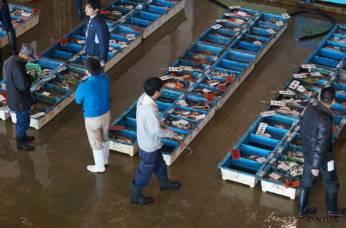
Frozen tunas are spread across the floor at the Misaki Fish Market. Buyers move about and inspect each tuna to determine their quality. A small sample on top of the tuna allows the buyers to see a cross-section and determine the amount of white meat versus red meat. Buyers then place bids for specific tunas on small chalkboards. The one with the highest bid gets to purchase the tuna.

These tools are used by the fisherman on the boats and while in port. All three tools are made from the sharp end of the swordfish!
|
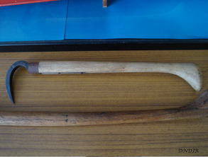
Tools are necessary to move frozen tuna on the market floor. This is because the tuna are frozen to -60 degrees Celsius and cannot be touched directly.
|
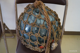
This is an example of a traditional glass buoy
that has been used in Japan. Most of these buoys have been replaced by rubber buoys.
|
|
Jogashima Island 城ヶ島
Area 1 Square Kilometer Coastline Length 4 Kilometers Relative Location Southern Tip of Miura Peninsula Absolute Location / Geographic Coordinates 35°08'00.4"N 139°37'14.4"E |
|
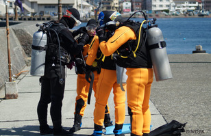
An instructor prepares his SCUBA diving students before entering the water off of western Jogashima.
|
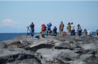
Birdwatchers congregate on the western shore of Jogashima in hopes of seeing shearwaters
close to shore.
|
A fisherman weighs a bag of dried hijiki at
Jogashima port. Hijiki can contain high levels of inorganic arsenic but Japan has no health warnings against consuming it.
|
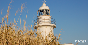
Jogashima lies across Misaki Bay and is accessed via an inexpensive toll bridge. Jogashima has ample parking around the island. While no longer is affordable for families. If you park to the west you will be in the vicinity of Jogashima lighthouse and several shops and restaurants. IF you park in the center, near the end of the toll bridge, you will be in the vicinity of Jogashima Park. Jogashima Park itself has parking for several hundred cars and provides quick access to the park and coastal waters. The central area of the park is has several shelters, vending machines and observation areas. Trails lead down to the coast waters and the rocky shore facing the entrance to Tokyo Bay. There are also several trails that will take you across the sandy beaches and over to the Jogashima lighthouse.
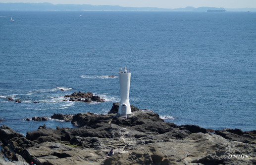
Awazaki lighthouse is located on the eastern end of Jogashima. In the distance it is possible to see ships that are entering and exit Tokyo Bay.
|
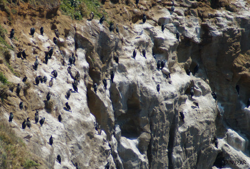
Cormorants congregate on the cliffs of the Jogashima facing the Pacific Ocean.
|
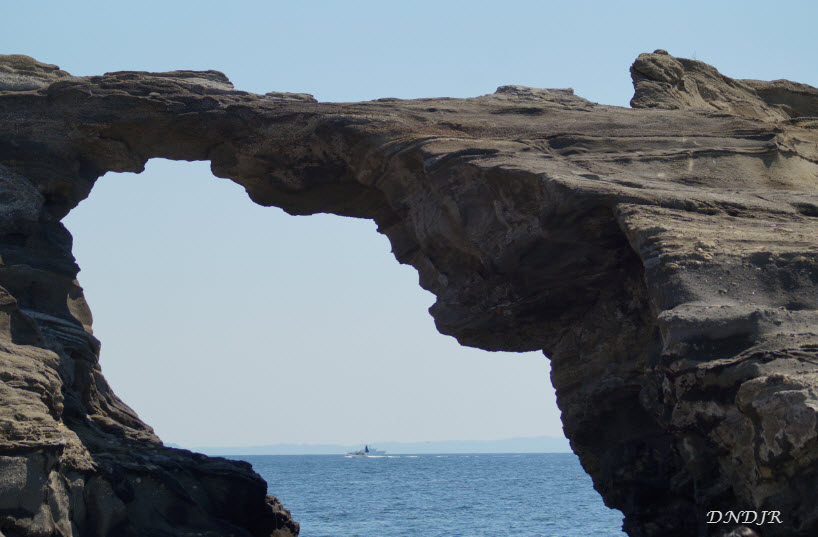
Umanose-Domon is a natural bridge formed by eroded rock. It is located about half-way across the southern edge of the island.
|
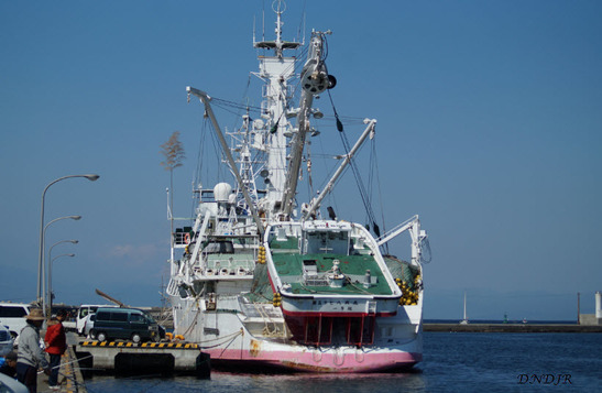
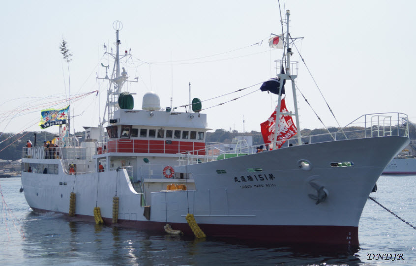
The Hakko Maru No.57 is a purse seine tuna
fishing vessel . The small boat on the stern is
used to drag the huge purse seine net around schools of fish. It is licensed to operate in within the Solomon Islands and other Pacific Ocean fishing grounds.
|
Koajiro Forest in Miura City 小網代の森
Relative Location - In Muira City Next to Koajiro Bay
Absolute Location - Geographic Coordinates 35°09'50.9"N 139°37'49.7"E
Address and Phone - 〒238-0225 Kanagawa Prefecture, Miura City - 046-823-0381
Parking Location - Near Aburatsubo Park ( 35°09'38.5"N 139°37'05.6"E )
Relative Location - In Muira City Next to Koajiro Bay
Absolute Location - Geographic Coordinates 35°09'50.9"N 139°37'49.7"E
Address and Phone - 〒238-0225 Kanagawa Prefecture, Miura City - 046-823-0381
Parking Location - Near Aburatsubo Park ( 35°09'38.5"N 139°37'05.6"E )
|

|
|
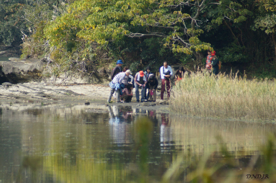
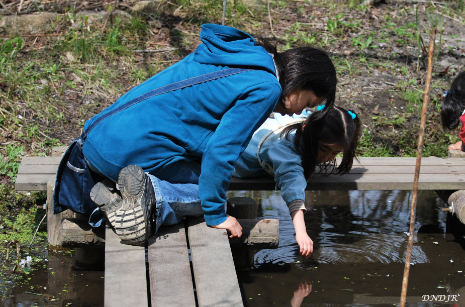
Half a century ago Koajiro forest was much different than it is today. The flat bottom land was occupied by rice patties and the hillsides were covered with trees that were occasionally cut down for lumber. In the 1970s the land came into disuse and it became very dry. Bamboo spread across the area that was once used to grow rice. The area that is today called Koajiro forest was eventually purchased by Kanagawa Prefecture. Over the years various groups worked to preserve the area. Then, in 1998, a non-profit organization has created to restore the land and create a wetland environment. Since that time teams of volunteers have worked hard to clear the bottom land and widen the river and numerous streams that flow through the forest. They have also cut down the ubiquitous bamboo and replace it with flora that thrives in wetland environments. These two things have benefited the natural environment and created an ecosystem where nature can thrive.
|
|
|
|
Koajiro is a fun to place to visit. Most of the trails are covered with board walks that make it relatively easy to traverse. Perhaps the major drawback to visiting Koajiro is the distance from parking. Most people who visit Koajiro park at the Aburatsubo parking lot. You then have to walk about twenty minutes down to the park entrance. You can also take the train to Keikyu Misakiguchi Station walk to park. Ask for directions at the station. This too is about a twenty minute walk!
|
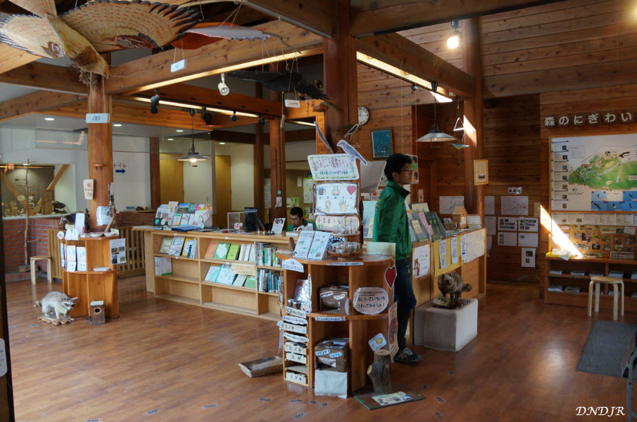
Kamigo Mori No Ie in Yokohama City 上郷・森の家
Relative Location - Next to Rt. 23 Close to Exit #5 at Asahina on the Yokohama - Yokosuka Expressway (Yoko-Yoko)
Absolute Location - 35°20'30.9"N 139°34'59.4"E
Address - Kamigōchō Sakae Ward Yokohama City, Kanagawa Prefecture 〒247-0013
Relative Location - Next to Rt. 23 Close to Exit #5 at Asahina on the Yokohama - Yokosuka Expressway (Yoko-Yoko)
Absolute Location - 35°20'30.9"N 139°34'59.4"E
Address - Kamigōchō Sakae Ward Yokohama City, Kanagawa Prefecture 〒247-0013
|

|
|

|
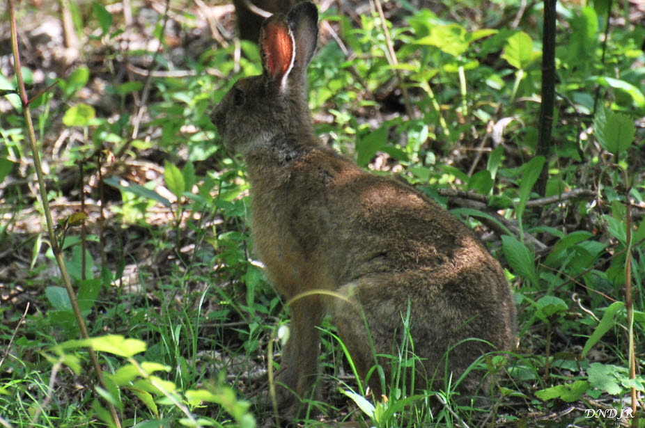
Yokohama Nature Sanctuary is located in Sakae Ward in Yokohama City. It lies next to several other nature and
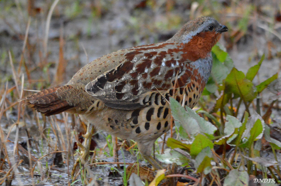
park areas that have been established by the local government. Although located on the edge of Yokohama, visitors are often surprised at how quiet and "out of town" it feels. This is especially surprising when one considers that the Yoko-Yoko highway is located a stone's throw away. The major path and side trails offer hikers and bird-watchers alike a chance to see variety of flora and fauna. Some areas have wooden steps and boardwalks to make hiking easier. The visitor center is a great place stop after you arrive. It has interesting animal and bird displays, as well as maps of the forest park. The observation area at the pond is popular with bird watchers and those who want to glimpse kingfishers. Many bamboo partridges call the forest home, but they can be difficult to see. Shrikes, buntings, finches, and warblers are very common. While squirrels are common, you have to be patient to see the occasional rabbit or tanuki. Four major trails twist their way through the park: • Mizuki Trail (dogwood) • Konara Trail (acorn) • Tanpopo Trail (dandelion) • Uguisu Trail (white eye bird) |
|
|
|
Physical Geography of Kanagawa Prefecture
|
Major Bays
Major Beaches
Major Lakes
Major or Significant Islands
Major Peninsula Miura Peninsula / Miura Hanto 三浦半島 Major Rivers
Major Mountain Ranges
Major Mountains of Kanagawa Prefecture
Other Physical Geography
|
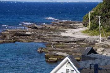
The Sagami Bay Coast of Miura Peninsula
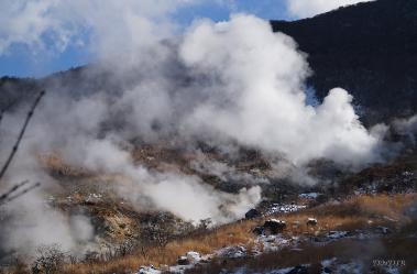
Fumaroles vent clouds of steam and gas above the
Owakudani volcanic area in Hakone, Kanagawa
Prefecture.

Enoshima 江の島 sits in Sagami Bay and is a popular
tourist destination.
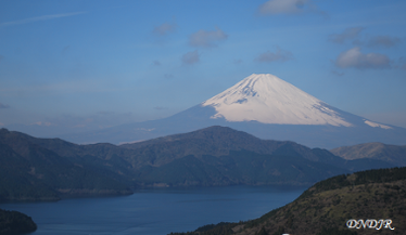
Beautiful Lake Ashi, known as Ashino-ko 芦ノ湖 in Japanese, is shown with Mt. Fuji in the distance. Mt. Fuji
is located on the border between Shizuoka Prefecture
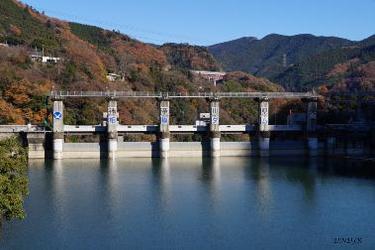
Lake Tanzawa 丹沢湖 and Miho Dam

Monkey Island, known as Sarushima 猿島 in Japanese,
sits in Tokyo Bay off Yokosuka City. It is said to be
the largest remaining natural island in Tokyo Bay.
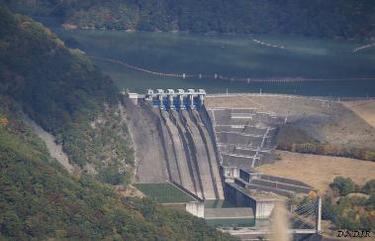
Sagami Dam 相模ダム on the Sagami River
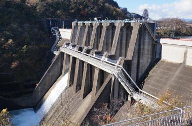
Shiroyama Dam 城山ダム on the Sagami River
|