Homework Assignment
Antarctica Poster Class Assignment
Antarcctica Poster Assignment
Work with your table-partner to create a teaching (informational) poster about Antarctica. Use the information on this page and the Antarctica page as your information source.
Details About the Assignment
The topic of your poster will depend on the group that you are assigned.
Work with your table-partner to create a teaching (informational) poster about Antarctica. Use the information on this page and the Antarctica page as your information source.
Details About the Assignment
- include the proper heading in the upper-left-hand corner of the page (with both names)
- include a large title across the top
- present the information clearly and accurately
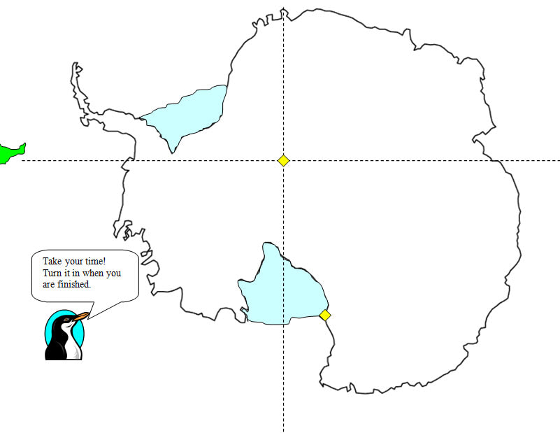
- include a map of Antarctica that is about six inches square
- include pictures that are directly related to your content
- make your poster colorful, neat, and interesting
- complete and turn-in by the end of next class period
The topic of your poster will depend on the group that you are assigned.
- France and Vietnam Groups - The Geography and Weather of Antarctica
- Australia and United Kingdom Groups - The Antarctic Treaty System
- Spain and Canada - Fauna of Antarctica
- All Other Groups - The History of Antarctica
Antarctica Lesson 1 - Antarctica Lesson 1 Deductive Learning Assignment - Pictures
Use a sheet of typing paper to complete this assignment. Start by drawing two lines to create four boxes of approximately equal size. Then, pick four of the pictures on the right side of the Antarctica page. There are six to chose from starting with Adalie penguins. Draw one picture in each box and then write a full sentence about it. Use the captions as your information source, but remember to make a full sentence using your own words. Make your drawings neat and colorful. Put your completed assignment in the class basket.
Use a sheet of typing paper to complete this assignment. Start by drawing two lines to create four boxes of approximately equal size. Then, pick four of the pictures on the right side of the Antarctica page. There are six to chose from starting with Adalie penguins. Draw one picture in each box and then write a full sentence about it. Use the captions as your information source, but remember to make a full sentence using your own words. Make your drawings neat and colorful. Put your completed assignment in the class basket.
Middle East Map Assignment
DoDEA Standard
6.3c Mesopotamia, Yellow River valley, Indus River valley, and Nile River valley complex societies and civilizations
adapted to and modified their environment to meet the needs of their population.
6.1c The physical environment influences human population distribution, land use, economic activities, and political connections. Note- To understand scale, students will work with maps at a variety of scales so they can compare patterns in population density and land use, economic activity, and political connections across the present-day Eastern Hemisphere, within a region of the Eastern Hemisphere, and in a specific country. In doing so, students will examine maps of the hemisphere, three regions within the present-day Eastern Hemisphere, and one specific country within each region.
In-class Assignment / Homework - Use the map on the United Arab Emirates page to complete the assignment and to use guide. You will be given a sheet of paper on which to complete this assignment.
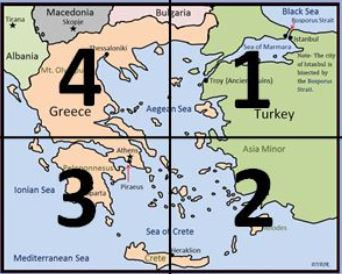
Step 1 - Draw the map on the paper provided before you label any locations. Do not worry about making a perfect copy of the map! Your task is to draw the map so that the countries and bodies of water are in the correct general location on the map. Making the country "look perfect" is not part of this assignment. Keep in mind that the map locations in these countries are areas that we study: Egypt, Sudan, Iran, Iraq, Syria, Turkey, and Israel. It is highly recommended that you use the method show show below to divide your map into four quadrants. The diagram below is an example of the quadrant method that was described in class.
Step 1 - Draw the map on the paper provided before you label any locations. Do not worry about making a perfect copy of the map! Your task is to draw the map so that the countries and bodies of water are in the correct general location on the map. Making the country "look perfect" is not part of this assignment. Keep in mind that the map locations in these countries are areas that we study: Egypt, Sudan, Iran, Iraq, Syria, Turkey, and Israel. It is highly recommended that you use the method show show below to divide your map into four quadrants. The diagram below is an example of the quadrant method that was described in class.
Step 2 - Label the map. Label only the countries and water (rivers, seas)
Step 3 - Bring it to class without adding any color.
Note- Finish the assignment for homework. No student should need to work more than 45 minutes on this assignment at home.
Step 3 - Bring it to class without adding any color.
Note- Finish the assignment for homework. No student should need to work more than 45 minutes on this assignment at home.
In-class Assignment (Use the cia.gov World Fact Book as your information source today.)
Step 4 - Work with your table-partner to determine the population of seven countries that you labeled on your map. Draw a small stick figure, in the seven countries, for every ten million people than lives in each country (round up or down as necessary).
Step 5 - Use the database to determine the major export of the seven countries. Draw a picture (icon) in the country that reflects the chief export. Note - The chief export is always listed first.
Step 6 - Pretend you are a ship captain and your ship is docked in Kuwait. Draw the route that your ship would take to a Turkish port on the Black Sea. Highlight the route using a red color pencil.
Step 7 - Lightly shade the seven locations and the water on your map.
Step 8 Critical Thinking Question - What are three statements (about your seven countries) that you can make about your data? Write the three data statements on the back of your map and then come up to discuss your data statements. Also be ready to discuss the grade that you think you deserve out of 15 points. If your work represents your best effort and you completed all of the steps- give yourself full credit.

